Maps
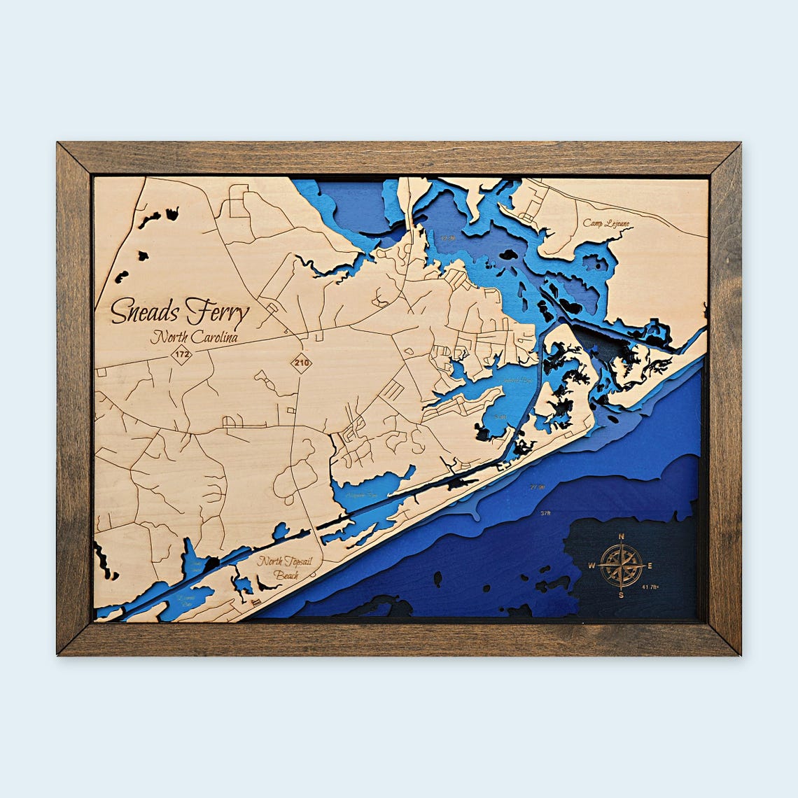
Sneads Ferry NC Framed 3D Wood Map
$119
In stock · made to order
About 16 x 12 in · Landscape
Buy on EtsyHandmade on Topsail Island, NC. Sneads Ferry, NC, the New River inlet and the north end of Topsail, layered in wood and framed. Add a free heart or house marker on your beach house, wedding spot or favorite pier, and we'll send a digital proof before cutting. A Christmas gift for anyone who loves the Carolina coast: order by early December for delivery before Christmas.
The frame is laser cut too and stained to match the photo unless you ask for something different.
Celebrate Sneads Ferry and the North Topsail coast with this framed, layered wood map. Engraved roads and place names sit above shades of blue water, showing the waterways and coastline in dimensional detail.
DETAILS
• One framed physical wood map
• Approximately 16 inches wide x 12 inches tall; landscape orientation
• Natural wood tones, layered blue water, and the gray-brown frame shown
• Three sizes available: 9x12, 12x16 or 16x21 in; choose your size at checkout
The photos show an actual finished map made in our shop, including close-up and angled views. Additional maps are made to match this design and finish. Natural wood grain, color, and small handmade details vary from piece to piece.
A coastal accent for a beach house, living room, office, or a thoughtful Sneads Ferry housewarming gift. Display props are not included. Decorative artwork; not for navigation.
Made by Shoreline Creations in coastal North Carolina. Please see the processing and delivery estimate shown by Etsy.